By Bunyod Holmatov, Sardor Khamidov, Zafar Gafurov, Kakhramon Djumaboev and Jonathan Lautze

The shrinking of the Aral Sea is the visible result of the destructive mismanagement of water resources in Central Asia. The Aral Sea was once the fourth largest lake in the world at 68,000 square kilometers, but has now shrunk to 10% of that size. It has fragmented into several water bodies, the largest of which are the North Aral Sea, which only receives water from the Syrdarya River, and the South Aral Sea, which depends on inflow from the Amudarya River.
The problem is that only a small fraction of the two rivers’ flows currently reaches these lakes. In the 1960s, the Soviet Union decided to regulate and divert their flows to irrigate land in Central Asia – sealing the unfortunate fate of the Aral Sea. Since then the environmental, climatic, humanitarian and socio-economic consequences of dwindling water pose great threats to local communities, their health and their sustainable development. Complicating the situation greatly, the drainage basin of these rivers is shared by seven countries: Uzbekistan, Tajikistan, Turkmenistan, Kyrgyzstan, Kazakhstan, Afghanistan and Iran.
A small step in the right direction
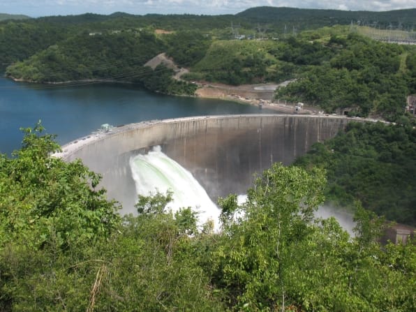
While it is unlikely that the Aral Sea’s surface area will be restored, there has been progress. Thanks to the construction of the Kokaral dam the North Aral Sea is recovering, as the dam prevents water from spilling into the South Aral Sea. This is, however, a traditional engineering solution for a problem that was caused by past, traditional engineering. Going forward, we need to find alternatives to this type of approach that move away from a reliance on gray infrastructure toward solutions that integrate nature. At the same time, increasing water demand for food and energy in the region threatens to further deplete water flow. Therefore, to ensure the sustainability of such efforts, it is important to secure stable water inflow from the rivers, calling for a systematic water–energy–food–environment nexus management approach.
In this context, CGIAR’s NEXUS Gains Initiative focuses on advancing integrated water storage management – combining traditional storage options such as dams with alternative water storage options like soil moisture and groundwater aquifers. Increasing alternative storage options may reduce reliance on withdrawal from the Syrdarya and Amudarya rivers, removing the need for further infrastructure. All this may free more water to flow downstream into the Aral Sea to sustain the lake. Unfortunately, in the Aral Sea basin, we do not know enough about the alternative water storage options to seriously incorporate them into decision-making. Work is thus underway to assess alternative water storage options in the small transboundary tributaries of the Ferghana Valley.
The NEXUS Gains initiative in the Isfayramsai River basin
Within the NEXUS Gains Initiative, an International Water Management Institute (IWMI) team is focusing on water storage around the Isfayramsai River, a small transboundary tributary of the Syrdarya River located in the Ferghana Valley. Isfayramsai is shared between Kyrgyzstan and Uzbekistan, and like many transboundary rivers, faces water stress and deteriorating infrastructure (Figure 1). The river originates in the mountains of Kyrgyzstan and flows approximately 120 kilometers to where it meets the Syrdarya River in Uzbekistan.
The Isfayramsai basin encompasses glaciers and many small lakes, but knowledge of other natural water storage options, like soil moisture and aquifers, is limited. There are many issues in the area; for example, the Isfayramsai is prone to extreme floods and there is no early warning mechanism. In addition, outdated irrigation infrastructure has deteriorated, causing high water losses in the system and contributing to conflicts between water users and transboundary tension.

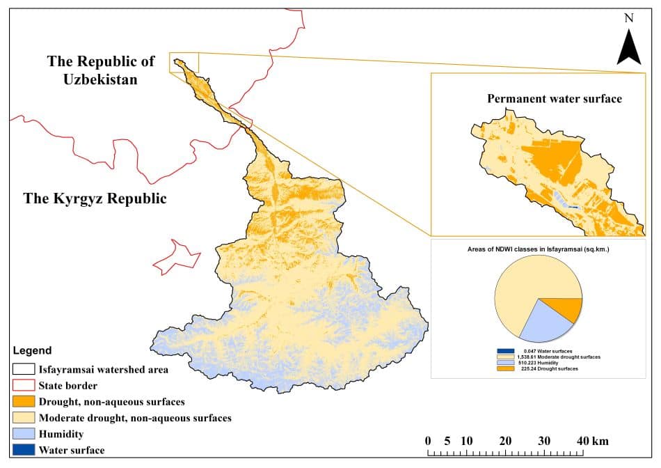
In 2022, a team from IWMI visited sites in Kyrgyzstan and Uzbekistan. They engaged in discussions with local stakeholders to identify water challenges and storage management practices in the Ferghana Valley. Stakeholders reported that the key challenges were disruptive water shortages in early spring and the inability to utilize flood water for productive uses. They expressed keen interest in expanding storage options in the basin. To address this, the IWMI team has used a combination of remote sensing and modeling techniques to understand and develop maps of groundwater potential zones, soil moisture index and surface water bodies.
Surface water bodies were analyzed using the Normalized Difference Water Index – used to determine open water bodies in satellite images by allowing a water body to stand out against the soil and vegetation (Figure 2).
IWMI is now working to assess the temporal changes of each storage type in the area to understand if a broader suite of storage options can be used to satisfy water demands. There has been a recent warming of transboundary relations, especially in the water sector. Kyrgyzstan is transferring land with the Andijan reservoir to Uzbekistan in exchange for other land. This means there could be key opportunities under current governments to advance integrated storage management across borders. We hope the evidence generated through the NEXUS Gains Initiative helps to improve water management across all sectors and ultimately to reduce the devastating impact that mismanagement has had on the environment and people.
Bunyod Holmatov is a Researcher in Data Analysis and Innovation in Water Management at the International Water Management Institute (IWMI); Sardor Khamidov is a Consultant for IWMI Central Asia; Zafar Gafurov is a Researcher in Remote Sensing-GIS, IWMI Central Asia; Kakhramon Djumaboev is a Researcher in Water Management, IWMI Central Asia; and Jonathan Lautze is a Researcher and Research Group Leader, Integrated Management of Basins and Aquifers, IWMI South Africa
This work was carried out under the CGIAR NEXUS Gains Initiative, which is grateful for the support of CGIAR Trust Fund contributors: www.cgiar.org/funders


